The shift from grassland to cropland in the Prairies has increased losses of organic matter and plant nutrients from the soil. It is estimated that the original organic matter levels have fallen by 40 to 50%. Over the past century the ecozone has been radically transformed and only a small fraction remains in its native state. Perhaps less than 1% of the Tall-grass Prairie, 18% of the Short-grass Prairie, and 24% of the Mixed-grass Prairie remain.
Today, the Tall-grass Prairie region of Manitoba is almost completely cultivated. Over 90% has been converted to crops or drastically changed by grazing and haying. And 75% of the Mixed-grass Prairie and Aspen Parkland has been converted to cropland or seeded to non-native forage species. The Aspen Parkland, the northern transition zone to the Boreal Forest, has expanded south into former grasslands since settlement put an end to prairie fires. The natural vegetation is generally dominated by Spear Grass, Wheat Grass, and Blue Grama Grass. Sagebrush is abundant. Local saline areas feature Alkali Grass, Wild Barley, Greasewood, Red Samphire, and Sea Blite. Drier sites in the southwest are home to yellow Prickly Pear Cactus.
The Short-grass Prairie occupies the driest southerly arc of the region, where brown and dark brown soils are dominant. The northern edge of the ecozone is dotted with groves of Trembling Aspen and Balsam Poplar and characterized by black Chernozemic soils. The most productive soils in the region are the black, dark grey, and dark brown soils of the Aspen Parkland and the Tall-grass and Mixed-grass Prairie.
Lakes and wetland areas are rich in vegetation. Depending upon rainfall, there are between 1.6 and 7.1 million wetlands in this ecozone, and lakes cover 7 800 square kilometres. The greatest number of wetlands occur along the subhumid Northern Grasslands and adjacent Aspen Parkland, where they make up half the land area. However, lake and wetland areas are under threat. Virtually every major natural water system has been extensively modified and developed for hydro and thermal power generation, irrigation, flood protection, and water management. Agriculture and urbanization have cut the number of wetlands in half.
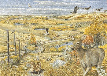
Few deciduous trees and shrubs grow in the ecozone except in the eastern regions, sheltered locations along waterways or at upper elevations. The east is characterized by Trembling Aspen and shrubs, whereas the southwest displays a mixed montane-type open forest of Lodgepole Pine. Southwest Manitoba contains a forest reserve that occupies most of the higher elevations of Turtle Mountain.