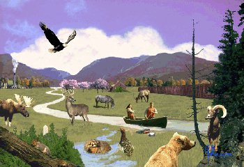
The 473 000 square kilometres of the Montane Cordillera Ecozone stretch from north-central British Columbia southeast to the southwestern corner of Alberta. The ecosystems range from alpine tundra and dense conifer forests to dry sagebrush and grasslands. Wetlands and small lakes dot the landscape, but there are also large, deep lakes and major river systems, including the Fraser and the Columbia River headwaters.
Much of this ecozone is rugged and mountainous. The major plains are more extensive in the north and extend out as intermontane valleys towards the southern half of the ecozone. Most of these plains and valleys are covered by glacial moraine and to some degree ancient riverbed and lakebed deposits, whereas the mountains consist largely of fallen rock debris and rocky outcrops.
The Columbia and Rocky mountains within this ecozone have a complex geology consisting largely of folded and faulted sedimentary bedrock. The mountain cliff faces disintegrate rapidly to form course, rocky slopes, fans and aprons.
Moist Pacific air carried by westerly winds drops large amounts of rain and snow as it ascends the windward side of the Coast Mountains. The air drops over the eastern slopes into the Montane Cordillera, where it compresses and warms, causing clouds to thin out. The pronounced rainshadow cast by the massive Coast Mountains makes the valley bottoms of the south-central interior the driest climates of B.C. The air releases moisture again, creating an interior rain belt as it ascends the Columbia, Skeena, Ominica, Cassiar, and finally the Rocky mountains, which define the eastern extent of this ecozone.
Annual precipitation in the higher elevations ranges between 1 200 and 2 200 mm. The northern and interior portions of the ecozone receive between 500 and 800 mm annually. The driest rainshadow areas around Merritt and Cache Creek and the southern Okanagan receive well below 500 mm of precipitation.
Much of the ecozone has an interior continental climate dominated by easterly moving air masses that produce cool wet winters and warm dry summers. Periodic inundation by dry, high-pressure, continental air masses results in a few cold winter days and a few hot summer days. Temperatures vary with altitude. In the alpine, no month has an average daily temperature above 10°C. The upper forested slopes have seven to nine months per year of monthly mean temperatures of no more than 0°C. The Ponderosa Pine forests are the driest and, in summer, the warmest forests in B.C., with mean July temperatures averaging 17°C to 22°C. The hot, dry summers result in large moisture deficits during the growing season. The rainshadow grasslands and valley bottoms are characterized by hot, dry summers and moderately cold winters with little snowfall. It is not unusual to have daily high summer temperatures topping 30°C.
