For generations, the blue lakes and rocky shores of the Canadian Shield have shaped our national identity and psyche. This raw and rolling landscape has left its imprint on some of Canada’s best literature, art and drama. Almost two thirds of the country lies on Shield rock. Canada’s largest ecosystem, the boreal forest, forms a continuous belt from the east coast to the Rockies. Scientists call the area where the Canadian Shield and the boreal forest overlap the Boreal Shield, the largest of Canada's 15 terrestrial ecozones.
Stretching 3 800 kilometres from Newfoundland to Alberta, the Boreal Shield includes parts of six provinces, covers more than 1.8 million square kilometres, and encompasses almost 20% of Canada's land mass and 10% of its fresh water. Some of Canada’s largest rivers have their headwaters in the Boreal Shield, including the Nelson, Churchill, Rupert and St. Lawrence. Huge bodies of freshwater, including lakes Winnipeg, Superior and Huron, lie along its borders. Within it are countless other lakes, some big, such as Lake Nipigon and Lac St. Jean, others so small they remain nameless to this day.
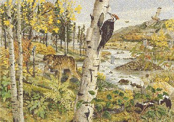
More than just bedrock and bush, the Boreal Shield is home to animals renowned as emblems of Canada’s north woods: the Beaver, Moose, Woodland Caribou, Wolf and Black Bear. This well-watered land also provides habitat for migratory ducks and geese drawn here each spring by the thousand.
The original inhabitants of this land -- the Beothuk, Algonquians, and Iroquois -- abided by its complex cycles and the movements of its animals. By the late 1700s, the area’s rich fur, timber and mineral resources had attracted the interest of Europeans. Two hundred years later, frontier resources still form the backbone of the Boreal Shield’s economy. While the footprint of industrial development remains relatively small, far-sighted management practices will be needed to sustain the Shield’s resources for the enjoyment of future generations.