The ecozone contains one of Canada's two major mountain chains. The mountains of the Arctic Cordillera span two geological "provinces," each with its own distinctive rock type. The mountains of volcanic rock range in age from 1.2 billion to 65 million years old. The mountains of southeastern Ellesmere and eastern Baffin Island belong to the older Churchill province, which is typified by Canadian Shield rock, a mix of granites, metamorphic gneisses, and ancient sediments.
Glacial ice engulfed northern Canada near the beginning of the Pleistocene epoch 2 million years ago. Since then, huge glaciers, far exceeding the depth and extent of present ones, have swept over this landscape at least four times.
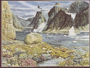
The main paths of the Pleistocene glaciers are marked by deep U-shaped valleys, which in coastal areas merge with steep-sided fiords that may rise over 1 000 metres above the sea. Past and present glaciers have created bowl-like cirque basins, pyramidal peaks called horns, knife-edged ridges or aretes, and other landforms.
After being depressed into the Earth's crust by the colossal weight of Pleistocene ice, the landscape is now rising, in places by as much as 30 cm per century. Raised beaches now well back from existing shorelines attest to this continuing process.
The climate is typically harsh, with long, extremely cold winters and short, cool summers, although the brief summer growing season is enhanced by long periods of daylight. Only July and August have mean daily temperatures above the freezing point. Eureka, Canada's coldest and most northerly weather station, has an average annual temperature of -19.7oC and a February mean monthly temperature of -38oC. A typical year sees just 250 mm of precipitation, although it is much higher in Labrador.