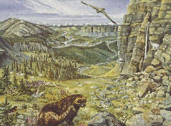
Much of the Tundra Cordillera Ecozone is characterized by steep, mountainous terrain consisting of a series of sharply etched ridges and narrow valleys. Other features include rolling foothills, upland plateaus, and low-lying basins.
The geological history of this region began about half a billion years ago. At that time, much of the area was a shallow marine platform off the west coast of the ancient protocontinent that later gave rise to North America. Rivers flowing off the protocontinent deposited sand, mud, and gravel on this platform, creating the sandstones, mudstones, and shales that today make up much of the area's abundant sedimentary rocks. Limestone and dolomite, formed from the skeletal debris of marine organisms, are also common.
The original sedimentary rocks started to undergo significant folding and uplifting about 200 million years ago. This occurred as the platform on which they were laid down slowly drifted west, colliding with and overriding other crustal plates in its path. New chains of mountains sprang up in response to these collisions. The most active period of mountain building occurred about 100 million years ago, when local stresses beneath the Earth's crust forced red-hot molten rock toward the surface to produce the igneous rocks visible today.
Since then, these rocks have undergone slow but sure destruction by a variety of erosive forces: glacial ice sheets that engulfed much of the region several times over the last few million years; streams and rivers carved down through the high plateaus and mountains; and the simple action of gravity, which causes mountains to gradually collapse. Some of the most unusual landscapes are, however, now near the Beaufort Sea. These areas escaped glacial scour.
The cyclic freezing and thawing action of permafrost-rich soils enhances these processes of disintegration. The resulting polygon and stripe-like patterns often seen in alpine areas attest to the dynamic state of this ecosystem.
The climate is extremely cold and humid, with long, dark winters and short, cool summers. Precipitation is low to moderate, averaging from 250 to 300 mm a year across much of the ecozone. Snow and freshwater ice-cover persist for six to eight months annually.
