Much of the immense coastline contained in the ecozone is characterized by fjords, cliffs, and bald rock created by advancing and retreating glaciers about 10 000 years ago during the last Ice Age. There are more than 440 000 islands along the coasts. Offshore, the continental shelf extends to a distance of about 150 kilometres, with water depths from 200 to 300 metres. Within the ecozone, tides range from 9 to 12 metres. In parts of the Gulf of St. Lawrence, tidal action is much smaller, with average fluctuations of less than a metre. However, tides to challenge those of the Bay of Fundy occur in Ungava Bay.
Like the Pacific Marine Ecozone, the Northwest Atlantic forms a transition between the cold northern waters and the more temperate southern waters. Major ocean currents flow through it — cold arctic waters carried south by the Labrador Current merge near the Grand Banks with the warmer flow of the Gulf Stream. Average temperatures differ by more than 20°C between the arctic waters and the Gulf Stream. In August, surface temperatures vary between 3 and 8°C. Beneath the surface, temperatures remain below 0°C year round, but sea salt prevents the sub-surface waters from freezing solid. In the Gulf of St. Lawrence, fresh water flowing from the St. Lawrence River keeps the salt levels lower.
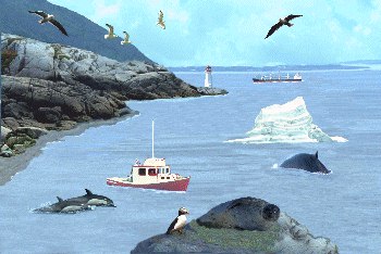
Sea ice is common throughout much of the ecozone, depending on the season and latitude. Ice begins to form off the coast of Labrador in November or December. By February or March, ice regularly reaches the northeast coast of Newfoundland and the Grand Banks, accompanied by thousands of icebergs. Most years, the St. Lawrence River freezes over, closing shipping. In May or June, the ice begins to clear and, by July, the coasts are ice-free well north on the coast of Labrador.