Few areas in Canada are comprised of extensive plains. Only parts of the central prairies and Northwest Territories are comparable. Churchill in northern Manitoba represents the approximate western edge of the Hudson Plain and it extends about 1 300 kilometres east to just beyond Fort Rupert in Quebec. To the north, the plains shoulder the waters of Hudson Bay and James Bay. From this coastline, the plain arcs south for 200 to 300 kilometres to Gillam, Mba., and close to Kapuskasing, Ont. Rising slowly from sea level, this flat lowland reaches an average elevation of just 120 metres.
The mineral soils that cover much of the area are finely-textured silt and clay deposited by both marine and glacial processes. Outcrops of the underlying sandstone and shale are rare. During the last ice age, the weight of the glaciers depressed the Hudson Bay region and the ocean waters later flooded areas up to 300 kilometres inland from the current coastline. During the retreat of the massive continental ice sheets, drainage into Hudson Bay was blocked and expansive lakes -- Agassiz and Ojibway -- were formed along the margins of the retreating ice. Seven thousand years later, the area is still rising. This has led to the development of the striking stripe-like features marking a succession of beach ridges. The lines, often composed of sandy material, radiate like ripples from the present-day coast, marking different stages of the rebound.
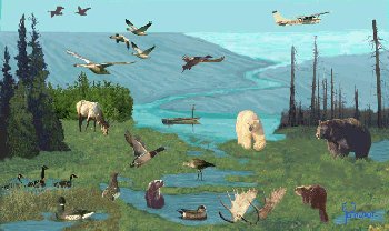
Since glaciation, the flat terrain, impervious soil and poor drainage have promoted the development of wetlands throughout the plains. Web-like or polygon patterns in organic soils are typical of northern wetlands. The widespread permafrost and ground ice also contribute to poor surface drainage and the slow rate of decay. Frozen organic soils predominate, while partly decayed organic soils are more common in southern parts and moderately weathered mineral soils are restricted to the warmer and drier locations, such as the beach ridges. Rivers and streams generally flow north-easterly to the coast and most have headwaters in the Boreal Shield ecozone to the south.
Major rivers include the Nelson and Hayes in Manitoba, the Severn, Winisk, Albany and Abittibi in Ontario, and the Eastmain and La Grande in Quebec. These rivers follow fairly long and straight routes. Flow varies dramatically over the course of the year and is virtually non-existent between September and January. In late summer, the channels may contain pools and stretches of trapped water, and spring floods can push water levels 10 to 15 metres higher than usual.
The narrow river valleys often provide the only areas of marked relief from the plains. These major rivers are fed by streams with gentle gradients and sluggish flows. Small, shallow ponds and lakes are numerous and dot the landscape in a leopard-like pattern. Ocean tides are weak and the currents flow counterclockwise around the bay.
Hudson Bay moderates the temperature of the lowlands during summer but the effect diminishes in winter when the bay is ice-covered. Cold, dry arctic air typically lingers over the area throughout winter. With little marked relief, the temperature and precipitation correlate closely with latitude.
Temperatures throughout the year tend to be colder near the coast and warmer inland. Summers are cool and brief. The average mean daily temperature in July ranges from 12°C to 16°C and in January it hovers around -25°C to -23°C. Frost free periods are shortest (about 70 days) on the coast and longest (80 days) along the southern margin. The average growing season ranges from 500 to 1 000 growing degree days above 5°C. Average annual precipitation is approximately 500 mm to 700 mm per year, and is lowest in the north. Rainfall peaks in the month of July at about 100 mm. Of this precipitation, snow accounts for very little; snowfall may be in the 2 000 mm range, half that of the Great Lakes area. The mean maximum depth of snow averages less than 1 000 mm. The spring break-up on major rivers tends to occur in late April or early May and ice jams can raise river levels by 7 to 10 metres.